")
")
Expedition onboard RV “G. Titov”, October 8-18, 2019
The expedition within the framework of the programs “Ecological and Economic Assessment of the Functioning of Freshwater Biocenoses…” and “Assessment and Forecast of Ecological State of Lake Baikal…” was carried out onboard RV “G. Titov”, October 8-18, 2019 throughout the water area of Lake Baikal.
The aims of the expedition were as follows: 1) to study vertical distribution of hydrophysical characteristics near gas seepages and in reference areas; 2) to study distribution characteristics of Baikal omul at local sites, compare them to the archival data, determine the characteristics associated with decrease in the omul stock, and establish possible hydroacoustic landmarks for stock changes; 3) to determine acoustic field near shallow gas seepages.
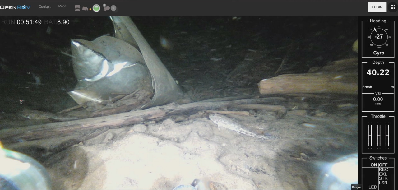
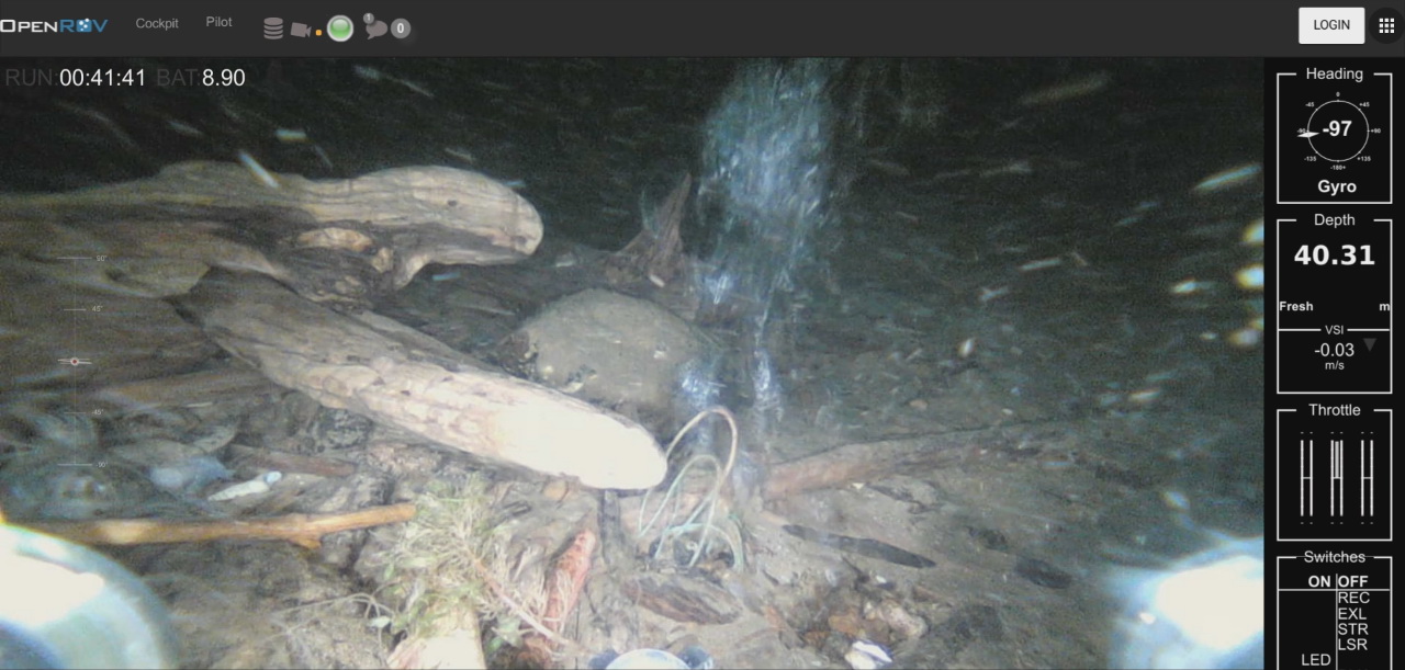
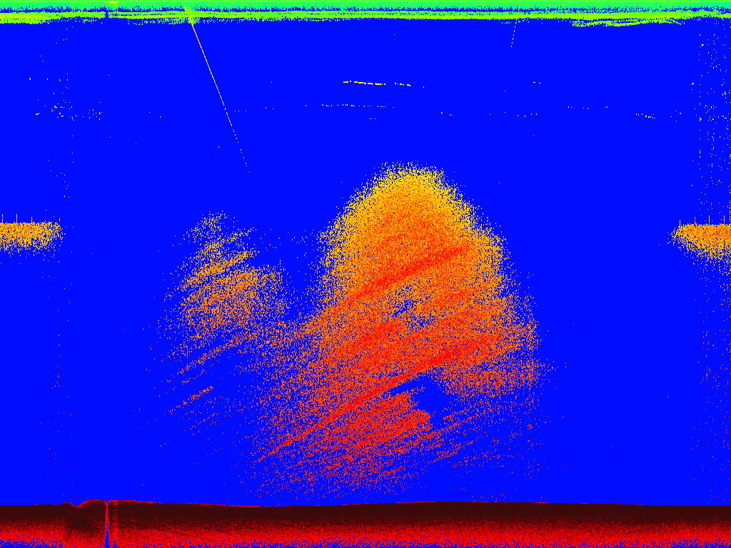
Vertical profiles of hydrophysical characteristics were recorded with an SBE-25 CTD prob, which was equipped with additional dissolved oxygen sensors, optical backscatter and water transparency sensors. From the board of the RV, the real-time operating SBE-25 CTD prob was set on a rod of the hydroacoustic equipment. Along the RV route, hydroacoustic equipment continuously operated. Fish aggregations, sound scattering layers of various nature and underwater gas seepages were recorded. In total, 15 vertical hydrophysical profiles including the coordinates of the center of gas seepages were performed.
Near the deep gas seepage Saint Petersburg that is located in the middle of the Vorota-Boldakovo section, CTD-probing was performed as close as possible to the vertical axis of the gas seepage. Analysis of the data revealed disturbances on the mineralization profile due to the influence of the floating gas bubbles. The probing at the Vorota gas seepage did not indicate the influence of the gas seepage on the vertical structure of hydrophysical parameters.
In the Selenga fishing region, the hydroacoustic survey of fish stocks was carried out along traverses from the coast to 350-m isobath. Traverses were the same as for the expedition in May of the current year. The obtained results enable to assess the stocks of hydrobionts and compare their distribution with the spring data.
During the expedition, the hydrometeorological station was repaired. This station is located in Uzury (Olkhon Island) and is a part of the network stations that measure the water level of Lake Baikal. The level measuring path, sensor and cable line were completely renewed. To date, four automated stations function in the scientific interests of limnological Institute: Listvyanka, Bolshiye Koty, Uzury, and the Ushkany archipelago.
.jpg)